
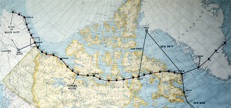
A tribute site to those who served on the coldest part of the Cold War,
the Distant Early Warning Radar Line.
“Sed evanescent voces scripta manent”
(Voices vanish but words remain.)
Get Lost!
Seriously! Get a cup of coffee and get lost in the more than 150 pages and over 1400 images that make up this site. Want help finding your way around? Download a PDF of the Site Map here.
Site Content & Links
In Memoriam
Sadly, this site’s founder, Larry Wilson, passed away on November 28, 2020 after long fight with Parkinson’s and Alzheimer diseases. The world has lost a true gentleman. He has left a hole in humanity that will never be filled. You can learn more about this incredible gentleman here.
As DEWLiners, and there are fewer and fewer of us left, we truly appreciate what Larry did for us. Without Larry’s efforts over many years, we’d be left with nothing other than our own fading memories.
This site is, and will always be known as, “Larry’s Site.”

Buy a book and support the site.
While maintaining this website is a labor of love for me, it does cost me money. If you would like to support this effort, please consider buying a copy of my book (proceeds go toward supporting the site). Your support would be most appreciated.
The book is available on Amazon here.
Thank you, Brian Jeffrey.